3.22.2014

Trout Lake: Alpine Lakes Wilderness

FOSS CREEK

Another day, another lake, and another gorgeous hike. Trout lake sits at low elevation in the North central part of the expansion Alpine Lakes Wilderness. 
Being a short 3.2 mile round trip hike its perfect for a quick half day trip or an all day summer lounge on the lake hike. 
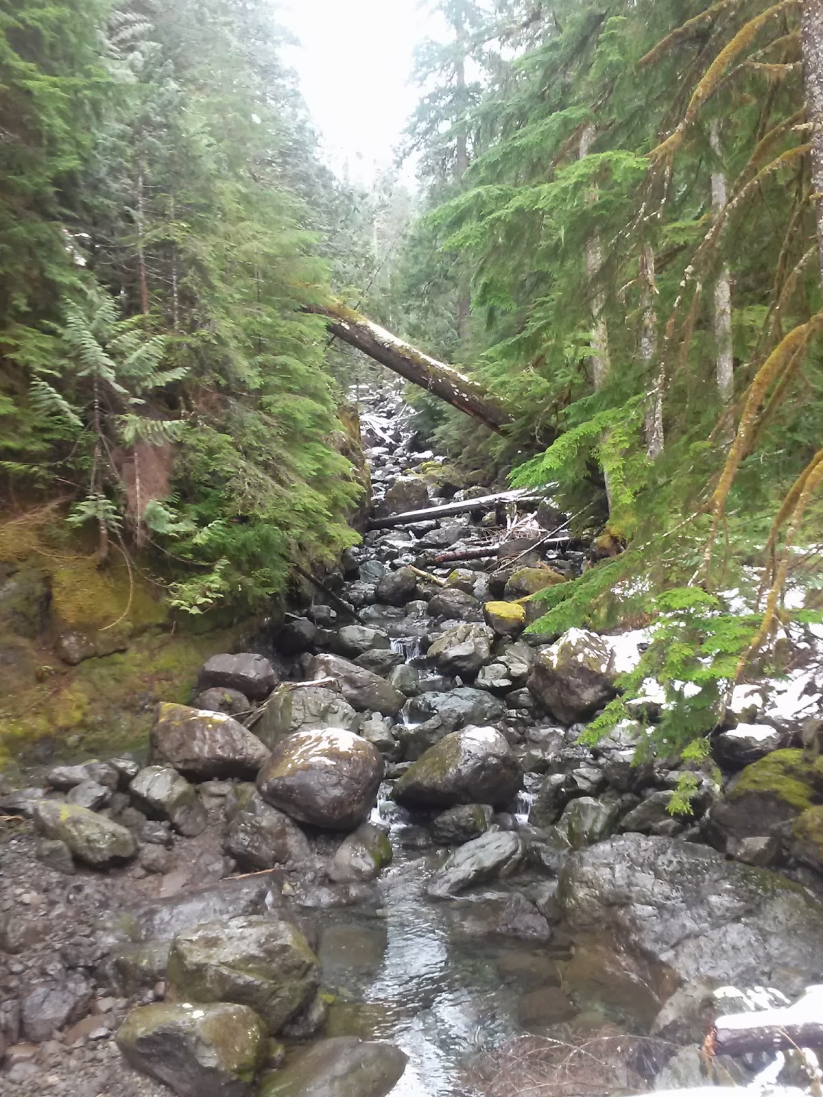
With fishing pole in hand we took to the trail. The trail starts of rather easy following the west fork of the Foss River. The river is close by almost the whole time. A bridge crosses over the river where below the bridge the river was flowing downstream but above the bridge there was no flow. Further up the trail the river is heard roaring again. It reminded me of how much more H20 there is to a mountain river that we don't usually see, via the underground path. 
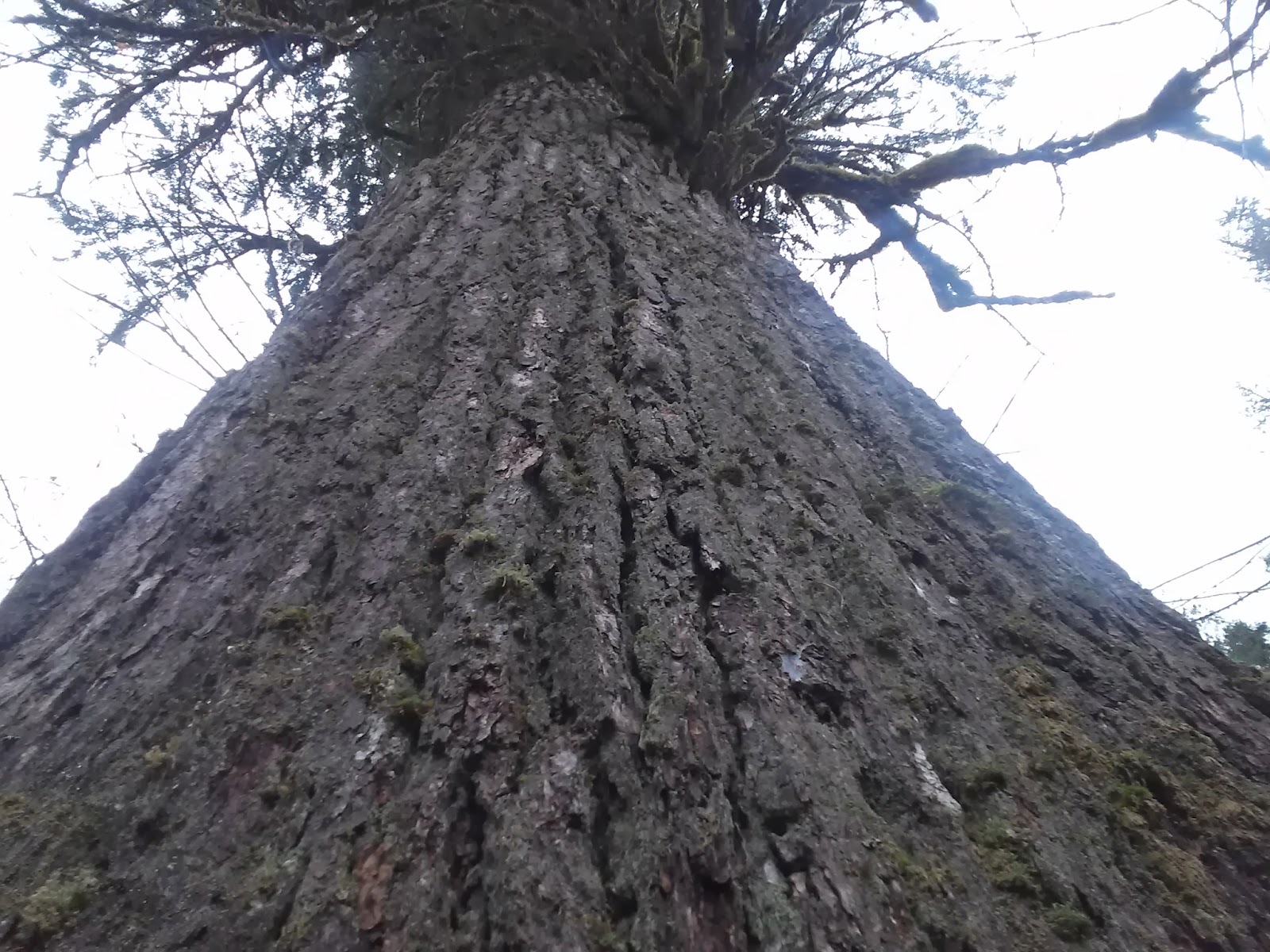
Next a GIGANTIC Fir stands alongside the trail about half way up. Its been awhile since I've seen anything larger. 
Snow covered the last half mile of trail which is where most of the elevation in gained.
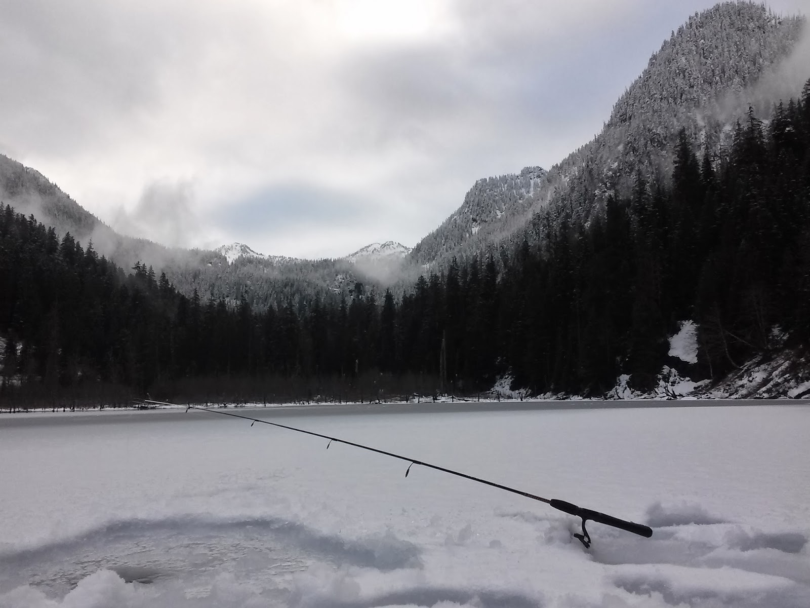
The lake was mostly frozen over but I threw my line into the outlet of the lake which was shallow, too shallow. I wanted to keep the few lures i had.Therefore we strategically decided on plan #2, ice fishing! 
After cutting through the ice we realized it was thick enough to support us. I dropped my line in about 20 feet away from shore and fished from the 1 1/2 ft diameter hole i was able to chisel out. NO luck!! No worries because the scenery was beautiful with a fresh covering of snow the forest glisten above us. The clouds broke and the sun popped its head out a couple of times to show off the snow capped mountains to the south of us.
All in all another great hike, another great lake and an amazing friend to share it with!!


ICE FISHING AT TROUT LAKE

LANDSLIDE SHOWY THE CRAGGY MOUNTAINS ABOVE

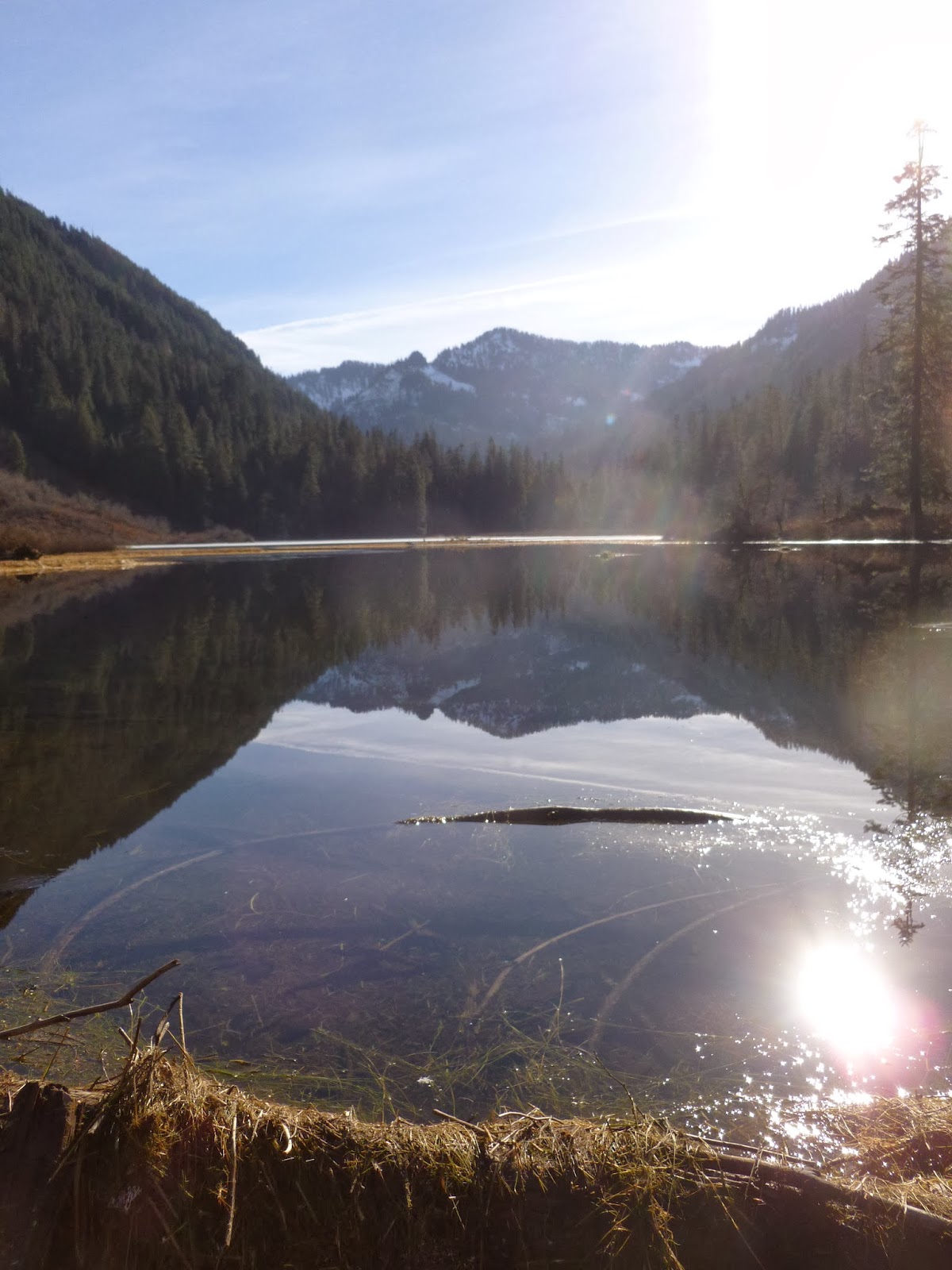
PANORAMIC VIEW OF LAKE
                                                              TRAIL INFO:
  
Trail: #1064

Miles hiked: 1.6 to the lake/ 3.2 miles round trip

Elevation gained: trailhead 1600 ft/ lake 2100           ft/ total of 5 feet gained

Forest: Mount Baker-Snoqualmie National                   forest/ Alpine Lakes Wilderness

Permit Required: NW forest pass

Trailhead Amenities: Parking lot, bathrooms,               picnic table

Map: Green Trails Maps 175

Wildlife seen: None

Fishing: None caught, supposedly has trout

Camping: numerous sites 

Trails close by: the same trail hikes another 5.7                  miles pass Lake Malachite, Copper                lake, Little Heart lake, and Big Heart lake

Trail condition: Great! Snow is trail, 3 downed              trees

Rules and Regs: No fires at Trout lake

Directions: Take Hwy 2. From hwy 2 take Foss            River rd (FR 6800) just east of the town of          Skykomish. After 3.5 miles take a slight              right and stay on 6800. After another .6              miles keep going past trailhead 1062. Then          after 1.3 miles take a left on FR 6835 and            the trailhead will be 1.9 miles ahead.


3.06.2014

Sunday Lake: Alpine Lake Wilderness

Sunday Lake, looking south


I recently bought a REI Quarter Dome T1 tent and needed to try it out. Like all outdoor gear junkies when i say "need" i mean "need". New toys are made to play with right away. Therefore i headed up to the Alpine Lakes Wilderness for a quick overnighter at Sunday Lake.
Sunday Lake is a low elevation lake at 1900 feet, in the far western portion of the Alpine Lakes Wilderness. 
I was hoping to do some fishing, thinking the lake would be mostly unfrozen.
The drive to the trailhead is on a bumpy long forest road. I used my phone's GPS and it took me through some of Hancock's forest roads which only lead me to an closed gate. I had to backtrack. Using Hancock's back roads is faster and less miles (nicer roads) compared forest road 5700 but if one of the gates is not open your screwed. Follow my directions on the bottom of this post for access to the trail. 
The trailhead is not much of a trailhead. It starts at gate 30. I had to park alongside the forest road as there's no parking spots. 
Heading up the forest road (5720) from gate 30 quickly i came to the Sunday Lake trail sign. Soon after the sign, i was forced to dance from log to log to rotten log around a year round pond. The logs are on the left side of the road.
After the pond the trail starts which really is an old logging road. After a rather easy stroll through the woods Sunday Creek is your first challenge and the main challenge depending on what time of year your hiking. From where the trail meets the creek i headed down stream about 500 ft. There i found rocks, slippery rocks, from which i jumped across with only one boot falling into the creeks icy hands. 
The trail starts up again just on the other side of the creek with red trail ribbons marking the rest of the trail. 
Next, remains from the old logging days are easily discovered just off the right side of the trail. 

Old Logging Equipment


From here the trail starts to climb as roots and rocks line the trail. I bet most of this upper section of trail is wet or is filled with a stream in spring.
After the last 1/4 of a mile, the hardest section, Sunday lake opens up as much as it can.
The lake is very marshy and with shrubs and trees lining the shoreline. The eastside of the lake is open which is the best location for fishing  as the shore itself is a large boulder field.
Sadly the lake was mostly frozen and i couldn't entice any trout to bite from the unfrozen shallow waters.
I did see several minnow sized fish dart by as i hiked around the lake.

Frozen part of the lake


They say never hike alone...... and never walk across a frozen lake.. alone. But I couldn't help myself. I scurried across the lake nervously with the sun's beams warming up the ice. I could hear ice cracking with it's echoes moving across the lakes frozen waters. I never could see the ice cracking as the ice was 4 inches deep.  I found a nice mossy area near the northern part of the lake and made camp. Perfect solitude, not a soul was on the trail. The evening Barred owl gave me company for several hours. 


Morning fire with my handmade cotton ball fire starter


Sunday Lake from my campsite


Trail: Sunday Lake trail #1000
Forest: Mt Baker - Snoqualmie National Forest,        Alpine Lakes Wilderness
Miles: 6.5 miles roundtrip
Elevation Gain: 400 feet
Elevation at Trailhead: 1500 feet
Elevation at lake: 1900 feet
Pass Required: NW Forest Pass Link to buy pass
Wildlife: Chickadees, Grouse- not sure what         kind, Hairy Woodpecker, Common                 Goldeneye, Barred owl
Fish: WDFW stocked Cutthroat Trout. No fish         caught, but did see two small fish. 
Camping: Permitted, i found four nice camping       spots, Fires permitted
Parking: Minimal, along the Forest Road, No         bathrooms
Directions: From North Bend - Take exit 31 to North Bend. Follow North Bend Blvd N, then take a right on W. North Bend Way. Quickly take a left onto Ballarat Ave N. Follow this for a little while as it will veer left and right and turn into NE 12 st. Soon veer left as 12th turns into 428 ave SE. Cross the Snoqualmie river twice then the road veers left and turns into N Fork Rd SE. Soon you will gaining elevation and join Forest Rd 5700 for about 14.5 miles to trialhead. Stay on this road for awhile and just pass gate 11 it will turn into Fury lake Rd/Forest Rd 5700. Don't take Gate 11 like i did!!! Follow this road until you cross the N. Fork of the Snoqualmie River. Park at gate 30/ NF rd 5720.